GOLD PROSPECTING, GOLD PANNING
EASTERN GOLD
North Carolina Gold Prospecting
South Carolina Gold Prospecting
Georgia Gold Prospecting
Virginia Gold Prospecting
Alabama Gold Prospecting
CALIFORNIA GOLD (Statewide) (Mexican
Border to Oregon state line)
Southern California Gold
Prospecting Map 1 (eastern part-adjacent to AZ and NV-Death Valley to
Yuma)
Southern
California Gold Prospecting
Map 2 (San Diego, Escondido, Santa Ana, Riverside, Palm Springs, Salton
Sea)
Southern
California Gold Prospecting
Map 3 (Ventura, Los Angeles, Lancaster, San Bernardino, Big Bear Lake,
Victorville, Barstow, Twentynine Palms)
Southern
California Gold Prospecting
Map 4 (Bakersfield, Randsburg east to Death Valley, Trona, Porterville,
Visalia, Fresno)
Northern California Gold
Prospecting Map 5 (Mother Lode- Yosemite, San Andreas, Columbia,
Sacramento, Grass Valley, Lake Tahoe, Oroville, Magalia, Downieville)
Northern California Gold
Prospecting Map 6 (N. edge of Map 5 to Oregon state line- Greenville,
Susanville, Redding, Weaverville, Trinity Center, Yreka, Happy Camp,
Crescent City)
REQUESTING GOLD MAPS
GOLD LINKS
METAL DETECTING
RESOURCES
ANCIENT RIVERS OF
GOLD
Gold Prospecting, Gold Panning
GOLD PROSPECTING AMD PANNING IS
FUN
Gold prospecting and panning
is said to be the nation's fastest growing outdoor recreation. Gold
prospecting and panning provide delightful recreation for young and
old. Many happy families combine gold panning with a picnic by a
beautiful stream.
WHY ARE PEOPLE GOLD
PROSPECTING AND GOLD PANNING?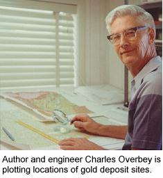
Is it because it is something the entire family can enjoy? Is
it the quest? Is it to get outdoors? Is it the thrill of finding
something that no person has seen before? Is it the hope of
finding a valuable gold nugget or gem? Perhaps the answer is
“A little of each."; but for most people the reason is
“It’s just plain fun and something I have always wanted
to do.”
There’s gold in them thar hills and Charles A. Overbey wants to help you find it. Overbey, an engineer, pilot and former NASA executive, has researched federal and state geological records and has authored a series of detailed maps for gold prospecting, gold panning, treasure hunting and rockhounding. His gold maps show thousands of specific sites where gold has been found.
By knowing where gold has been found in the past, you can improve your odds for finding more gold. The large scale gold maps give gold history and facts and tell you how to pan and where to look for gold in eastern United States and California.
It is easy to learn how to pan for gold by following the proven
step-by-step gold panning instructions printed on your gold map. You are sure to
get "gold fever!"
ALL YOU NEED
All you need to pan for gold is a shovel, an old dishpan or a gold pan, a magnifying glass, a pair of tweezers and a small plastic vial in which to put your gold. Gold pans are found at hardware stores, metal detector stores, rock shops, hobby shops
and on the internet.
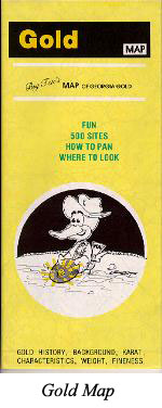
Big Ten's gold maps for gold prospecting, gold panning, treasure hunting and rockhounding are large size and large scale. They are printed in color on both sides of the sheet. Sheet size is 25 inches by 38 inches. The gold maps are folded to 4 1/4 inches by 9 1/2 inches. The scale is 1 to 250,000 (one inch = about 4 miles). Each gold prospecting and panning map is a composite of portions of several U.S. Geological Survey Topographic Map bases. For your benefit, contour lines are omitted so that details stand out clearly. You will see creeks, branches, dams, dry washes, mountains, canyons, national forests, secondary roads, trails, power lines, and rural schools and churches. You can tell the direction of flow of every little creek and branch. Each gold prospecting and panning map gives step-by step gold panning instructions. The scope of each state gold prospecting and panning map is described on the pages that follow.
WHAT TO SEE ON THIS WEBSITE
For your pleasure, information is expanded for each state
to include helpful gold prospecting and gold panning comments, gold history and the
cities near which gold
mines and prospects occur.
Also, be sure to see the "Gold Links" page for
links on gold prospecting and gold panning, the "Metal Detecting
Resources" page for more links about treasure hunting and
prospecting for gold and meteorites with a metal detector, and the
"Ancient Rivers of Gold" page.
The next page is EASTERN GOLD .
To see California gold map information go to: CALIFORNIA GOLD .